Research
Tools
© Antoni Costa
Balearic Biodiversity Center
Tools for Your Use
On this page, you can access a comprehensive list of links related to the field of biology. The list is continuously being developed, so if you have any links you’d like to add or if you find any broken links, don’t hesitate to contact us!
Biodiversity
| Web | Description |
| AlgaeBase | Global database containing free and open access to biodiversity data. |
| Bioatles | Biodiversity map of the Balearic Islands. |
| Biodibal | Local databases containing records of species from the Balearic Islands. |
| Biodiversity Information Standards (TDWG) | Non-profit organization and community dedicated to the development of biodiversity information standards. |
| Catalogue of Life | Global database containing a reliable list of species. It is maintained by hundreds of global taxonomists. |
| Encyclopedia of Life (EOL) | Global access to knowledge about life on Earth. |
| Ephemeroptera of the world | Global database including valid names, synonyms, bibliographic data, specimen data, images, sounds and distribution of ephemeropterans from around the world. |
| Euro+Med PlantBase | European database covering all native and introduced vascular plants from Europe, the Mediterranean and the Caucasus. |
| Fauna Europea | Reliable European database containing scientific names and distributions of all multicellular terrestrial and freshwater animal species currently known in Europe. |
| Fishbase | Global fish database providing taxonomic, nomenclatural and distribution information. |
| freshwaterecology.info | European database containing autecological characteristics, ecological preferences and biological traits, as well as distribution patterns of more than 20,000 European freshwater organisms belonging to fish, macroinvertebrates, macrophytes, phytobenthos and phytoplankton. |
| Global Biodiversity Information Facility (GBIF) | Global database containing free and open access to biodiversity data. |
| Integrated Taxonomic Information System (ITIS) | Global database containing reliable taxonomic information on plants, animals, fungi and microbes. |
| Ocean Biodiversity Information System (OBIS) | Global database containing open access data and information on marine biodiversity. |
| Ortoptera of the world | Global database including valid names, synonyms, bibliographic data, specimen data, images, sounds and distribution of the world’s orthoptera. |
| Plecoptera of the world | Global database including valid names, synonyms, bibliographic data, specimen data, images, sounds and distribution of plecopterans from around the world. |
| Species 2000 | Global database containing taxonomic information involving taxonomists from around the world. |
| Taxo&Map | Visualization tool that provides access to taxonomic and geographic distribution data of different species and taxonomic groups. It allows you to explore and analyze information about biological diversity, species distribution and other related data. |
| World Odonata list | Global list of the Odonata of the world. |
| World Register of Marine Species (WoRMS) | Global database containing a reliable classification and taxonomy of mainly marine species. |
Genetics
| Web | Description |
| Barcode of Life Data System (BOLD) | Platform that combines data storage and analysis tools developed for metabarcoding. |
| EMBL’s European Bioinformatics Institute | EMBL’s European Bioinformatics Institute (EMBL-EBI) maintains the most comprehensive range of freely available and up-to-date molecular data resources in the world. |
| European Nucleotide Archive (ENA) | European database providing a comprehensive record of the world’s nucleotide sequencing information, covering raw sequencing data, sequence assembly information and functional annotation. |
| Hight quality ribosomal RNA database (SILVA) | Global database providing comprehensive, verified and regularly updated datasets of aligned small (16S/18S, SSU) and large (23S/28S, LSU) subunit ribosomal RNA (rRNA) sequences for all three domains of life (Bacteria, Archaea and Eukaryotes). |
| National center for Biothecnology Information(NCBI) | Global database that includes biomedical and genomic information. |
R Studio
| Web | Description |
| ape | Package to perform phylogenetic analysis. |
| BAT | Package that includes algorithms to evaluate alpha and beta diversity in all its dimensions (taxonomic, phylogenetic and functional). |
| biomod2 | Package containing functions for modeling species distribution, calibration and evaluation, model ensemble, ensemble forecasting, and visualization. |
| biomonitoR | Package to manage ecological data and calculate biomonitoring indices. |
| dplyr | Package that provides a set of functions that help you solve the most common data manipulations. |
| envirem | R package for creating environmental variables useful for ecological research. |
| hypervolume | Package for estimating the shape and volume of high-dimensional data sets. |
| raster | Package for reading, writing, manipulating, analyzing and modeling spatial data. |
| rentrez | R interface to search databases of various gene banks. |
| rgbif | A programmatic interface to the web services methods provided by the Global Biodiversity Information Facility. |
| rredlist | R package to use the IUCN APIs. |
| sf | Package for working with spatial data. |
| terra | Package for managing spatial data analysis with vector data (points, lines, polygons) and raster data (grid). |
| vegan | Useful package for ordination methods, diversity analysis and other functions for ecologists. |
| wdpar | Interface to access the repository of protected areas worldwide. |
GIS
| Web | Description |
| Agencia Estatal de Meteorologia (AEMET) | AEMET mapping layers. |
| Blue Habitats | Global seafloor geomorphic data. |
| British Oceanographic Data Center (BODC) | Various marine data. |
| Chelsa | High resolution global climate data. |
| Copernicus Global Land Service | Global temperature of the earth’s surface. |
| Copernicus Marine Data | Various marine data (time series and remote sensing data). |
| Corine | Corine land cover of Europe. |
| Eurostat – Geographical information and maps | Data set of statistical units representing the European nomenclature of territorial units. |
| Food and Agriculture Organization of the United Nations (FAO) | Various spatial data. |
| GADM | Global dataset providing maps and spatial data for all countries and their subdivisions. |
| General Bathymetric Chart of the Oceans (GEBCO) | Global bathymetry data sets for the oceans. |
| Global Climate Monitor | Web viewer of global climate data. |
| Global Sea Level Observing System (GLOSS) | Global sea level data. |
| HydroSHEDSdatabase | Global digital data layers in support of hydroecological research. |
| IdeIB | Spatial data infrastructure of the Balearic Islands. |
| LP DACC | Various spatial data. |
| Ministerio para la transicion ecologica (MITECO) | MITECO mapping layers (biodiversity). |
| Ministerio para la transicion ecologica (MITECO) | MITECO cartographic layers (landscape). |
| Ministerio para la transicion ecologica (MITECO) | MITECO cartographic layers (biodiversity – terrestrial species). |
| Ministerio para la transicion ecologica (MITECO) | MITECO cartographic layers (biodiversity – Preliminary ecological bases for the conservation of species of community interest in Spain: Invertebrates). |
| Ministerio para la transicion ecologica (MITECO) | MITECO cartographic layers (biodiversity – Protected areas). |
| Ministerio para la transicion ecologica (MITECO) | MITECO cartographic layers (wetlands). |
| Ministerio para la transicion ecologica (MITECO) | MITECO cartographic layers (forests). |
| Ministerio para la transicion ecologica (MITECO) | MITECO cartographic layers (national parks). |
| Ministerio para la transicion ecologica(MITECO) | MITECO cartographic layers (biogeographic regions). |
| Ministerio para la transicion ecologica (MITECO) | MITECO cartographic layers (phytoclimatic regions). |
| Ministerio para la transicion ecologica (MITECO) | Miscellaneous cartographic layers. |
| Ministerio para la transicion ecologica (MITECO) – Infraestructura de Datos Espaciales de España | Miscellaneous cartographic layers. |
| NASA’s Ocean Biology Processing Group (OBPG) | Data and software for spatial analysis. |
| National centers of Environmental Information (NOAA-NCEI) | Various spatial data. |
| National Snow and Ice Data Center | Global data on snow, ice, glaciers and frozen soils. |
| Natura 2000 data | Layers of the European Natura 2000 program. |
| One Geology | Geological map of the world. |
| Physical Oceanography Distributed Active Archive Center (PO DAAC) | Ocean and climate data from NASA. |
| Portal de l’aigua de les Illes Balears | Online platform that provides access to data, studies, information and resources related to the water resources of the Balearic Islands. |
| SOCIB | Scientific and technological infrastructure that provides free and open oceanographic data streams. |
| Soil grids – viewer | Global database that stores a data-driven system that predicts soil properties and classes using global covariates and globally fitted models (viewer). |
| World Coastlines | World coastline (Princeton University). |
| World map of the Köppen-Geiger climate classification | Köppen-Geiger climate map. |
| WorldClim | Global climate data useful for ecological modeling. |
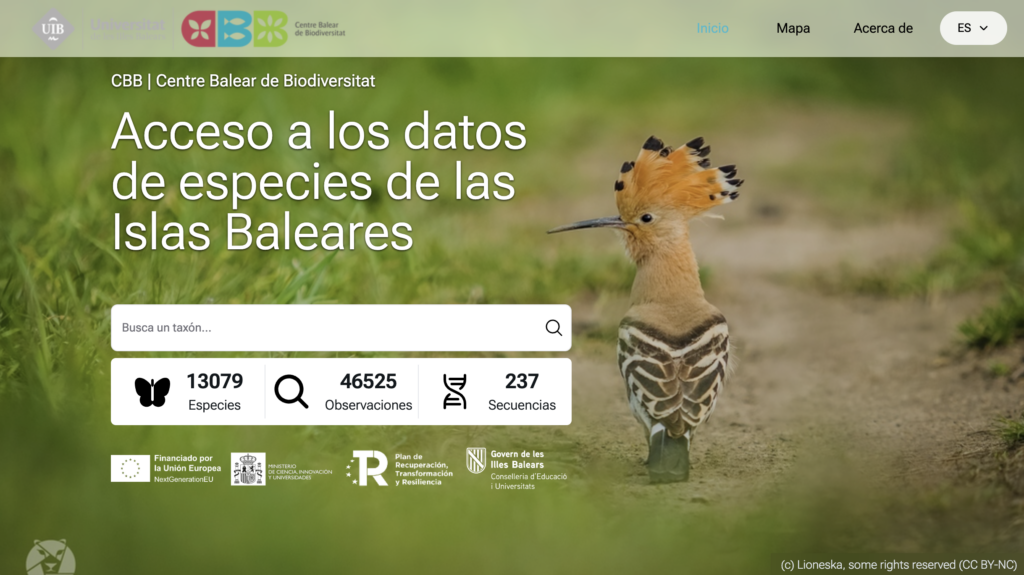
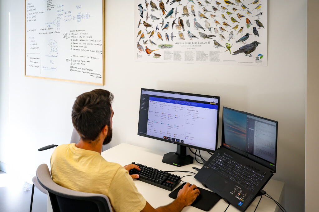
Our Biodiversity Platform
It is an advanced public IT system designed to collect, manage, analyze, and share data on the biodiversity of the Balearic Islands.
Our GitHub Repository
Our tools created for the management and analysis of ecological and bioinformatics data are openly available.